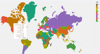
Although we love QGIS we prefer programmatic solutions when we have to visualize data. The Python ecosystem offers excellent tools to produce interactive and static maps. We tested Altair and Folium on the same dataset.
(more…)Tag: Altair
-
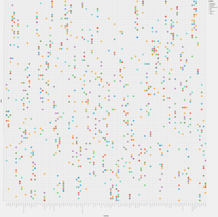
Which country is the best? Punch card version
-
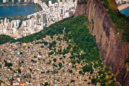
The urban geography of inequalities
A few weeks ago we had a heatwave and we were thinking if the hotter a place the poorer it is. We could collect data to test our hypothesis thanks to the recent advances in open data and scraping technologies.
(more…) -
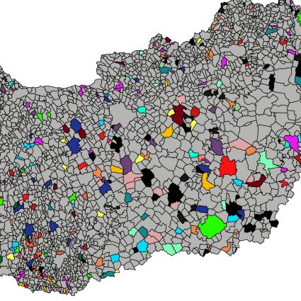
City name lego
City names in Hungary are like lego parts. You can put together two ore more words almost freely and get an existing city name. However one can easily discover some pattern of the names, i.e. their reasonable proportion ends with the same word. Our project aims to map the most frequent endings of the municipality names of Hungary.
(more…) -

Demographic changes of Hungary between 1986 and 2018
The population of Hungary has been decreasing since the 1980s. How does this change affect the rural and urban areas? What is the ratio of males and females in the municipalities of Hungary? Our project aims to answer these and similar questions by illustrating tendencies of the population change regarding each municipality of the country, city size, and sex.
read more